Transportation

Cedar Bayou Crossing Corridor Study

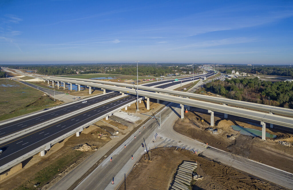
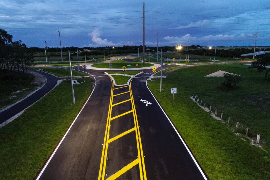
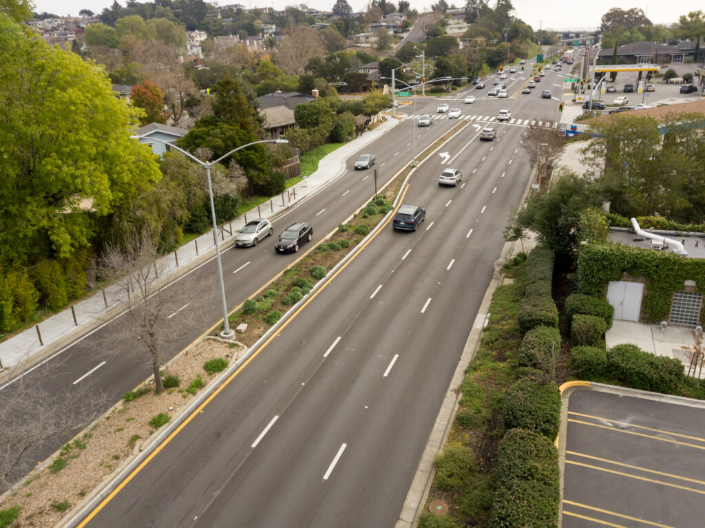
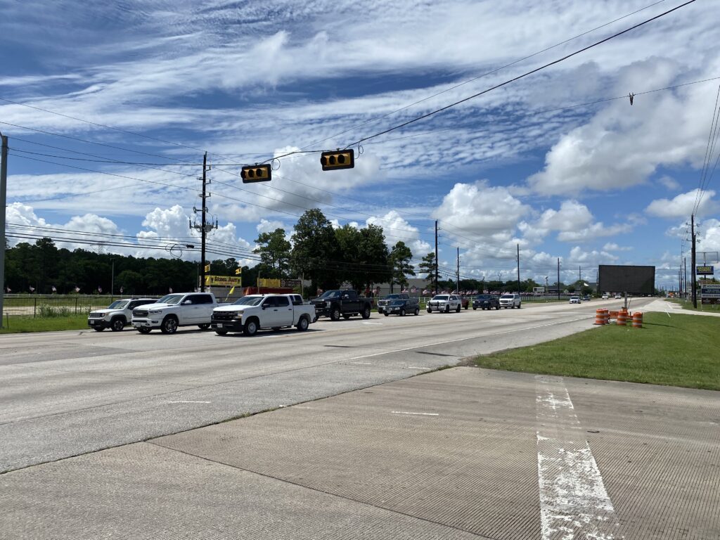
Cedar Bayou Crossing Corridor Study Harris County and Baytown, Texas DCCM was selected to provide professional services for the proposed Cedar Bayou crossing. The crossing will serve as a critical link for the City of Baytown to ensure the orderly development of the northern part of the city and provide necessary east-to-west mobility to supplement IH 10. The project area was from Hunt Road at Main Street to Kilgore Parkway at SH 146. DCCM provided project management, data collection, existing condition evaluation, alternative analysis, community outreach support, preliminary engineering, geotechnical investigation, subsurface utility engineering, survey, and an environmental analysis. DCCM conducted a corridor study to identify alignment alternatives and assess the project’s feasibility. The study included several aspects to consider and required sufficient information to measure and evaluate a range of viable improvement options. The traffic analysis reviewed traffic and crash data, existing roadways, traffic flow patterns, traffic counts, turning movement counts, and transit and traffic operations. The DCCM team conducted capacity analyses for designated locations and sections of roadways and made recommendations to improve traffic flow. DCCM provided hydrology and hydraulics (H&H) to support the corridor layout of the proposed roadway. This task used the latest Mapping, Assessment, and Awareness project (MAAPNEXT) models for Cedar Bayou as developed by the Harris County Flood Control District. DCCM also provided community outreach, public meetings, and City Council meetings. The project concluded with identifying recommended improvements, preliminary plans with several alternatives and their estimated costs, and a preferred alignment. Surveying Services DCCM performed professional surveying services to obtain and review existing lidar data and the limited preliminary ground survey data for the Cedar Bayou Corridor Study. The project spanned 3.7 miles from North Main Street, 3,300 feet south of IH 10 (west tie-in point), to the intersection of SH 146 and Kilgore Parkway (east tie-in point). The latest available lidar data published from USACE and Texas Natural Resources Information System covering the project area to evaluate and perform the following tasks: Data sets were extracted/downloaded into Esri ArcGIS (Pro+3D Analyst tool) and Context Capture/OpenRoads Cross-data checks were performed against public datasets from TxDOT, the City of Baytown, Harris County, and other available online resources. The MicroStation DGN deliverable included: DEM 2D building/structure footprints Roads, highways, and railroads Overhead transmission lines Other visible features within the lidar data Limited field surveying was performed. Field surveying tasks included setting four project control points, performing limited topographic surveying along North Main Street (1,000 feet north and south of the west tie-in point) and SH 146 (500 feet north and south of the west tie-in), and obtaining cross sections along the existing railroad running through the project. Field surveying also included determining the elevations of the existing railroad running at the railroad bridge over SH 146 and confirming (spot-checking) the lidar data in several accessible areas. The survey data was based on the NAD 83, Texas Coordinate System, South Central Zone (4204) CORS adjustment. Elevations were based on the NAVD 88 2001 adjustment relative to the lidar data. The survey information was provided in MicroStation Select Series 10. At a Glance 3.7 Miles $140 million Construction Cost Markets Transportation Surveying Services Transportation Surveying Utilities Water & Wastewater

Aerial view looking straight down at a multilane highway with a new crosswalk intersecting both directions of travel lanes

FM 2818 (Harvey Mitchell Parkway) Improvements

FM 2818 (Harvey Mitchell Parkway) Improvements College Station, Texas The FM 2818 (Harvey Mitchell Parkway) project in College Station showcases coordinated planning and innovative design to address regional growth and evolving transportation needs. DCCM led efforts with the City of College Station, TxDOT, Texas A&M University, and Easterwood Airport to improve corridor operations and support future expansion. DCCM’s scope included topographic surveying, ROW and easement identification, corridor and traffic analysis, conceptual alternatives analysis, environmental documentation, public involvement, subsurface utility engineering (SUE), and management of eight subconsultants. The team completed both schematic and PS&E phases, producing a geometric design from Wellborn Road to F&B Road and transitioning efficiently to construction documents by maintaining consistent staff and project management. A detailed topographic survey was completed for the 1.8‑mile corridor, covering an unusually large 80‑acre ROW. Prior baseline data from the 1970s and earlier DCCM utility surveys ensured accurate property and easement mapping. A comprehensive corridor and traffic analysis showed conventional intersections would not meet long‑term capacity needs. DCCM evaluated additional conceptual alternatives and identified a “superstreet” (Restricted Crossing U‑turn) as the preferred solution, reducing signal phases, improving traffic flow, and preserving flexibility for future controlled‑access upgrades. Environmental constraints along White Creek required careful grading and barrier design to minimize impacts on wetlands and floodplains. DCCM kept impacts below permitting thresholds and avoided additional ROW acquisition. DCCM also performed extensive SUE Quality Level (QL) B investigations covering more than 265,000 linear feet of utilities, revealing critical conflicts. Twenty-four QL-A test holes confirmed existing conditions and guided necessary design refinements. At the same time, additional QL-B work on side streets ensured a complete understanding of utility impacts despite tight timelines and traffic-control constraints. The project faced several significant design challenges, including a major underground electric duct bank that conflicted with proposed roadway and drainage improvements. Through SUE QL-A investigations and coordination with the City of College Station and TxDOT, the team adjusted the drainage while leaving the duct bank in place, thereby avoiding costly relocations. The late addition of the Jones‑Butler Road overpass required rapid schedule and design modifications without affecting the letting date. At a Glance 40% Reduction in Corridor Travel Times $57.6 million Construction Cost Markets Transportation Environmental Services Transportation Surveying Utilities

SH 249 (Tomball Tollway), Phases I and II

SH 249 (Tomball Tollway), Phases I and II Tomball and Montgomery County, Texas DCCM was contracted by the Harris County Toll Road Authority (HCTRA) as the Program Management Consultant (PMC) for the design and management of both preliminary and final project designs, as well as construction management and inspection services for Phase II. We developed a project feasibility assessment, which resulted in the SH 249 (Tomball Tollway), Phases I and II engineering feasibility report, and served as the basis for the final design. On its first day of operation, eager toll users doubled the projected 17,000 daily toll transactions, cutting traffic on the existing frontage road in half. Funded entirely with toll road revenue paid by drivers who choose to use the Harris County toll road system, the final construction will extend the toll road into Montgomery and Grimes Counties to SH 105, streamlining trips to and from rapidly growing Grimes County and College Station. Phase I: Spring Cypress Road to FM 2920 This project provided travelers with four main lanes in each direction and was constructed between the existing TxDOT northbound and southbound non-tolled frontage roads. As PMC for HCTRA, DCCM completed an aggressive 9-month design program to deliver plans, specifications, and estimates (PS&E) for HCTRA to bid and construct this phase. DCCM provided leadership, schedule adherence, quality assurance, and oversight to 17 consultants, completing the PS&E for four new toll lanes in each direction along a 6-mile stretch of SH 249, adding five new bridges, retaining walls, and a drainage system that mitigates flooding. Drivers may now bypass seven stoplights while the frontage roads remain toll-free. All milestone submittals were met on time, and the project was constructed in only 16 months and under three construction contracts. Phase I was open to traffic in April 2015 and is exceeding all revenue forecasts.  Phase II: FM 2920 to Spring Creek (Harris/Montgomery County line) Design preparations for Phase II began in October 2014 with design revisions to the TxDOT 2006 SH 249 Schematic. As in Phase I, DCCM was the PMC for the design of four-lane toll lanes in each direction, adding three-lane frontage roads on both north- and southbound approaches, five major bridges, flood-mitigating storm sewer detention, a collegiate practice field, and equestrian and bike trails. Services also included computing cut-and-fill quantities for roadway sections, concrete and reinforcement steel quantities for bridge deck pours, and payments for such pours on the contractor’s pay estimate. DCCM monitored the roadway excavation, subgrade preparation, concrete milling, embankment placement for abutments, installation of drill shaft and foundations, concrete beam placement, asphalt pavement placement, bent footings, column, cap pours, reinforced earth walls, 18- to 36-inch reinforced concrete pipes, and various concrete box culverts. Our team oversaw construction management and inspection services for this segment of the project.  Phases I and II of the SH 249 (Tomball Tollway) project included environmental investigations and permitting, survey/ROW mapping, utility identification and assessment, subsurface utility engineering (SUE), and hydrologic and hydraulic (H&H) modeling and detention pond design. DCCM also provided construction phase services for Phase II and the direct connectors at SH 99 (Grand Parkway). Mainlanes, Phase I, Section 1 – Montgomery County MCTRA selected DCCM to prepare PS&E for mainlane and ramp construction for a 0.4-mile section of tollway north of Tomball, Texas. The project scope included roadway geometric design, traffic control plans, removal plans, drainage plans with both open and closed systems, SWPPP, cross-sections, general notes, specifications, and construction cost estimates. The DCCM team coordinated with both adjacent designers on the Montgomery County segment and with the design and construction teams of the Harris County segment to the south to deliver a synchronized product that minimized impacts to travelers and adjacent property owners and reduced overall project costs. At a Glance $101 million Phase I Construction Cost $99 million Phase II Construction Cost Markets Transportation Services Transportation Utilities Surveying Water & Wastewater

West Terre Haute Trail

West Terre Haute Trail West Terre Haute, IN This one-mile-long pedestrian trail is located along the south side of US 150 in West Terre Haute, beginning at Sumner Avenue and extending east to Schley Place. The goal of this project was to improve pedestrian safety, increase connectivity, reduce congestion, and improve air quality.  Prior to construction, pedestrians were forced to walk along the narrow US 150 shoulder beside traffic or behind the guardrail adjacent to the steep side slope, creating a dangerous and restricted walking path. With this project, West Terre Haute was able to provide an alternate route for commuting individuals, families, and those needing to access jobs without vehicles. This trail and bridge improved safety for pedestrians and vehicular travelers amidst increased US 150 traffic.  At a Glance 1 Mile Project Size $6.6M Project Cost ACEC State Finalist Project Award Markets Transportation Environmental Services Transportation

Brays Bayou Federal Flood Control, Multiple Channel Improvements, and Bridge Replacements

Brays Bayou Federal Flood Control, Multiple Channel Improvements, and Bridge Replacements Houston, Texas DCCM was contracted by HCFCD to provide engineering services for three separate projects for Brays Bayou. Channel Modifications, Discrete Segment 109 – DCCM evaluated the impact of the proposed channel widening on the existing foundation of eight bridges. DCCM also designed soil-nail and gravity retaining walls to protect the bridge abutments and to stabilize the bayou banks. Additional services included preparing a structural analysis of the proposed walls per HCFCD criteria, PS&E, force mains relocation design, relocation and replacement of existing storm sewer flap gate boxes, and an updated evaluation of the previous IH 610 bridge engineering report. Services also included an alternative final design, evaluation of existing bridge foundations’ capacity, and a recommendation on soil excavation impact.  Telephone Road, Lawndale Street, South 75th Street, and Almeda Road Bridge Replacements – DCCM provided preliminary and final design and bid and construction phase services for the replacement of the four bridges. DCCM investigated the site, reviewed record drawings and existing utilities, and conducted a topographic survey of the existing channel and bridges to supplement the data. DCCM assisted with the coordination of lane configurations and sidewalk widths to determine typical bridge sections and prepared exhibits showing alternatives for each bridge. DCCM prepared TCPs, local drainage design, SWPPP, a drainage area map, hydraulic calculations, and drainage standards. Construction cost: $23 million Stella Link Road and Ardmore Street Bridge Replacements – DCCM provided the design, coordination, scheduling, and PS&E for the replacement of the existing Ardmore Street bridge and addition of a new span to the Stella Link Road bridge. The project increased the hydraulic capacity of Brays Bayou by expanding the cross-sectional area under the bridges. The new bridge at Ardmore Street provided a U-turn, wider lanes, and sidewalks for community connectivity. The project included a compressed schedule to meet federal funding requirements, environmental issues, and utility coordination due to gas lines, storm sewer, gravity and force main sanitary sewers, and electrical and water lines on the bridges.  At a Glance $11 million Discrete Segment 109 Construction Cost $23 million Telephone Road, Lawndale Street, South 75th Street, and Almeda Road Bridge Replacements Construction Cost $23 million Stella Link Road and Ardmore Street Bridge Replacements Construction Cost Markets Transportation Services Transportation

Panther Parkway

Panther Parkway

Panther Parkway Sebring, FL PHASE I – In fall 2001, DCCM completed the design for widening approximately one mile of Fairmount Drive from a two-lane local road to a five-lane major collector with sidewalks. Construction was completed by the end of 2002 at a cost of $500,000. PHASE II – DCCM supported the County by designing highway lighting and signalization for six intersections and preparing the design and permitting for six stormwater retention ponds along the two-mile route. PHASE III – In January 2017, DCCM contracted with the Highlands County Board of County Commissioners to modify the design of a 4.3-mile segment of Sebring Parkway Phase III between Sebring and Avon Park. The original design and permit, completed by others, proved cost-prohibitive and jeopardized an FDOT CIGP Grant. Leveraging our expertise in stormwater permitting, DCCM redesigned the entire roadway and modified the Environmental Resource Permit, managing $3.2M in FDOT funding. Construction, estimated at $8M, began in March 2018. By August 2019, the north-end connection to the Memorial Drive Roundabout was completed, and the Sebring Roundabout (formerly Panther Parkway) on the south end was finished by year-end 2019. At a Glance 4.3 Miles Project Size $10M Project Cost Markets Transportation Services Transportation

Sir Francis Drake Corridor Rehabilitation

Sir Francis Drake Corridor Rehabilitation

Sir Francis Drake Corridor Rehabilitation County of Marin, CA DCCM provided construction management, inspection and public outreach services for the rehabilitation of Sir Francis Drake Boulevard between Highway 101 and the Ross town limits. The major traffic artery has a daily traffic load of 45,000 vehicles. The project objectives were to improve vehicle flow, transit operations, and pedestrian and bicyclist circulation and safety. The construction project scope included removal and replacement of 60,000 square feet of curb, gutter and sidewalk, 5,000 linear feet of post and cable fence, the installation of 8,500 linear feet of welded steel water line, 80 new water service connections, new signalization and video detection cameras at seven major intersections, new streetlighting, over 1 million square feet of cold planing, 25,000 tons of new asphalt pavement, traffic striping and markers, new and replacement storm drain piping and structures, 25,000 linear feet of new signal interconnection conduit and wiring. In support of these construction activities, we monitored contractor traffic controls, temporary intersection signalization, storm water pollution controls, quality assurance, and materials testing. At a Glance $18.1M Project Cost Markets Transportation Services Program Management

Scroll to Top