Articles

Articles

Advancing Compound Flood Modeling with an Integrated Approach

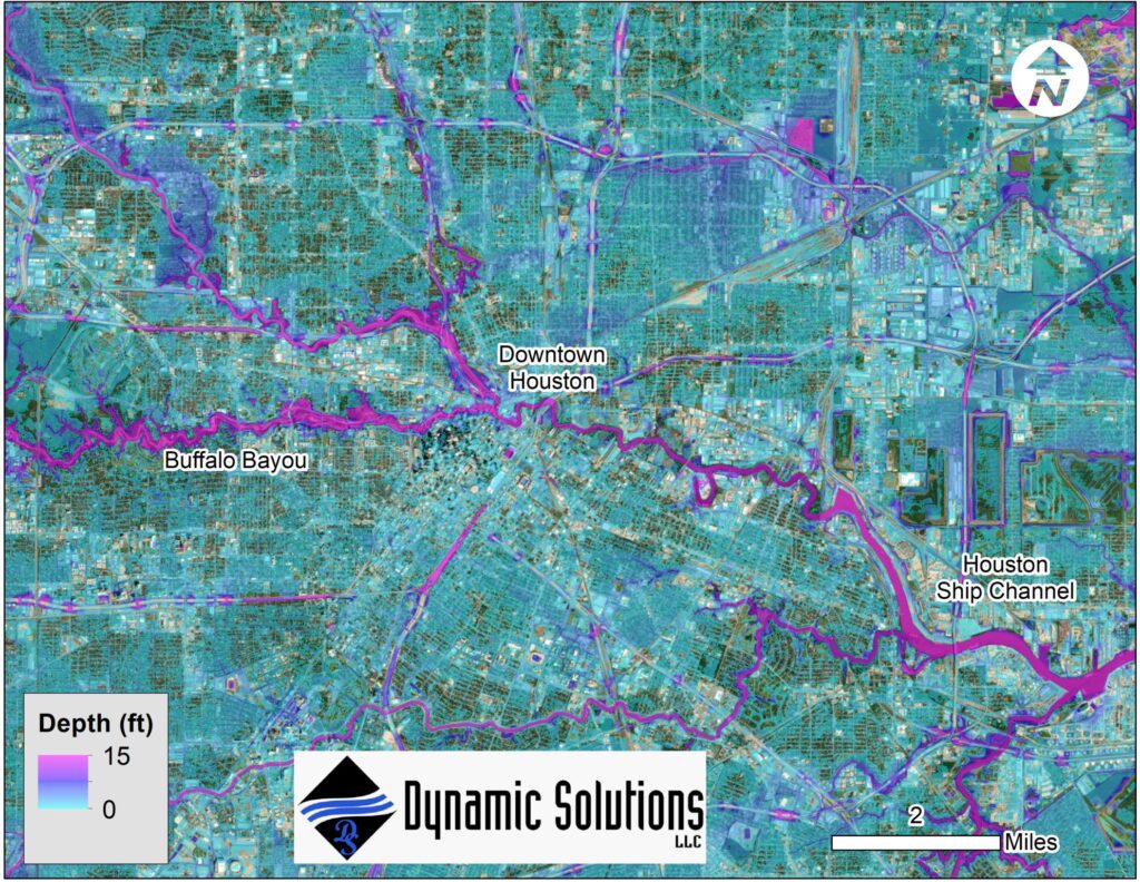
Flooding rarely occurs from a single source. During major storm events, heavy rainfall, riverine flooding, and coastal storm surge can occur simultaneously, creating compound flooding conditions that are more complex—and potentially more damaging—than any individual flood process. Understanding how these processes interact is critical to accurately estimating flood hazards and supporting resilient infrastructure planning. Yet, traditional modeling approaches often evaluate individual flood sources separately and then combine the results. While useful for certain applications, this approach may not fully represent the interactions occurring between rainfall, rivers, and coastal systems during an extreme event. DynamicSolutions | DCCM recently collaborated with the U.S. Army Engineer Research and Development Center (ERDC) to advance a more integrated approach to compound flood modeling. Capturing Multiple Flood Processes in a Single Model The project involved implementing an advanced version of the Adaptive Hydraulics Model (AdH) capable of simulating the combined impacts of heavy rainfall, riverine flooding, and coastal storm surge within a single modeling framework. By representing these processes together, the model can account for interactions that may be missed when individual flood sources are modeled independently. This provides a more integrated representation of how water moves through interconnected coastal and riverine environments during major storm events. The approach is particularly valuable in areas where rainfall-driven runoff, river flows, and coastal water levels can influence one another and contribute collectively to flood conditions. Applying the Model to Hurricane Harvey To demonstrate the advanced modeling capabilities, DynamicSolutions | DCCM and ERDC applied the model to Hurricane Harvey in Galveston Bay and Harris County, Texas. Hurricane Harvey provided an opportunity to evaluate a complex event involving multiple sources of flooding across a large coastal and urban environment. Using the advanced version of AdH, the team simulated the combined influence of heavy rainfall, riverine flooding, and coastal storm surge within a single model. Rather than treating these mechanisms as isolated processes, the integrated approach allowed their interactions to be represented directly within the simulation. Improving Our Understanding of Compound Flood Risk As communities plan for extreme weather and changing flood risks, understanding compound flooding is increasingly important. Flood hazard assessments that better represent the interaction among multiple flood sources can provide engineers, planners, and public agencies with more complete information for evaluating vulnerabilities and planning infrastructure improvements. Integrated modeling approaches such as this can help advance the way complex flood events are analyzed—providing a more comprehensive picture of how rainfall, rivers, and coastal systems work together during extreme conditions. DynamicSolutions | DCCM brings specialized expertise in hydrodynamic modeling and water resources engineering to help public agencies and project partners better understand complex flood processes and evaluate infrastructure challenges. Explore DynamicSolutions | DCCM’s services or connect with our team to learn how our modeling and water resources expertise can support flood risk assessment, resilient infrastructure planning, and complex water resources projects.
Articles

A Practical Approach to Sediment Transport Modeling

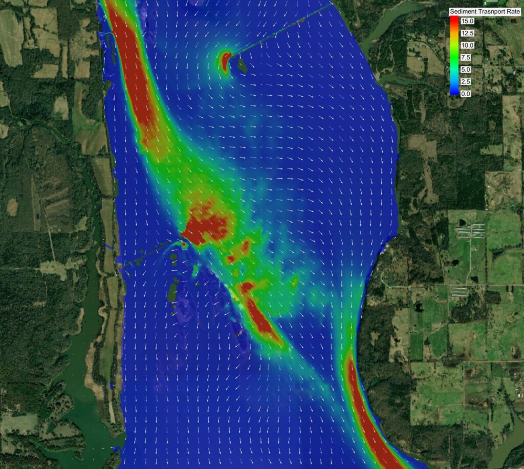
Sediment transport modeling can be an important tool for understanding how waterways respond to changes in flow, channel geometry, and proposed improvements. However, comprehensive numerical sediment modeling can also require significant data collection, computational effort, and budget. For many projects, particularly during early planning and alternatives development, that level of analysis may not be necessary. A more targeted approach can provide valuable insight while allowing project teams to focus resources where they will have the greatest impact. Using Hydrodynamic Modeling to Inform Sediment Assessments DynamicSolutions | DCCM recently applied this approach for a U.S. Army Corps of Engineers (USACE) study on the Arkansas River. Rather than beginning with a comprehensive numerical sediment transport model, our team leveraged results from an existing two-dimensional (2D) hydrodynamic model to estimate sediment transport capacity through a problem reach. The hydrodynamic model provided information about hydraulic conditions within the reach that could be evaluated in the context of sediment movement. Using these results, our team developed estimates of sediment transport capacity and assessed how proposed changes could influence conditions within the study area. Supporting Efficient Alternatives Screening The analysis provided a practical way to screen alternative designs for navigation improvements without immediately undertaking a more extensive sediment modeling effort. This type of approach can be particularly useful during early project phases, when the primary objective is to understand relative differences among alternatives and identify concepts that warrant further investigation. By using available hydraulic information to evaluate sediment transport behavior, project teams can narrow the range of alternatives before investing in more detailed analyses. It also allows the level of modeling effort to better match the decisions being made. If an initial assessment identifies significant sediment-related concerns or uncertainties, more comprehensive sediment transport modeling can then be focused on the alternatives and locations where additional detail is most valuable. Matching the Analysis to the Project Sedimentation studies do not always require the most complex modeling approach from the outset. The appropriate methodology depends on the project objectives, available data, site conditions, and level of detail needed to support decision-making. For the Arkansas River study, leveraging 2D hydrodynamic model results provided an efficient means of estimating sediment transport capacity and screening navigation improvement alternatives. The result was a focused analysis that provided useful technical information while recognizing the data, schedule, and budget considerations associated with more comprehensive numerical sediment modeling. By selecting an analytical approach that matches the questions a project needs to answer, engineers can provide meaningful sedimentation insights while reserving more intensive modeling efforts for situations where they are truly warranted. DynamicSolutions | DCCM helps public agencies and project partners apply practical, data-driven approaches to complex water resources challenges—from hydrodynamic and sediment transport modeling to navigation, river engineering, and waterway improvements. Explore DynamicSolutions | DCCM’s services or connect with our team to learn how our water resources expertise can support your next project.

Articles

Unnatural Wonder: Colorado River

This spring DynamicSolutions | DCCM’s own Steve Sanborn joined a Colorado River trip through the Grand Canyon. On the trip happened to be two journalists from The Arizona Republic working on a story about the effects of regulated flows on the Colorado River’s ecosystem. The reporters put together a great story and video, which uses footage and thoughts from Steve’s trip, about the challenges the river faces and efforts to revitalize the ecosystem. “A river once wild, muddy and warm now flows cold and clear, every drop measured out to supply cities and farms downstream. Water levels ebb and flow hourly, erasing the spring surges and summer droughts innate in desert rivers. Scientists manage nature’s cycles, adding what was lost, nursing what remains.” Read the Article

Scroll to Top
